Sunday 20 October 2013
Saturday 12 October 2013
Wales again, and again and again.........
 Bromsgrove, Kidderminster, Bewley, Cleobury Mortimer, Ludlow, Knighton…….., the last 6 week, every Saturday, I have driven through these towns en route to Wales to walk. The walks completed are:- 8/9 starting the Glyndwr Way from Knighton to Llangunllo 15/9 Glyndwr Way from Llangunllo to Felindre 21/9 final leg of the Birmingham to Aberystwyth Walk (well overdue!!) from Devil’s Bridge to Aberystwyth 29/9 final leg of the Wye Valley Walk from Llangurig 5/10 Glyndwr Way from Felindre to Llanbadarn Fynydd 12/10 Glyndwr Way from Llanbadarn Fynydd to Abbeycwmhir From this you can see the Birmingham to Aberystwyth Walk has finally come to a conclusion, walking to the coastline having started the walk back in 2007 and walking out of Gas Street Basin in Birmingham some years ago. I have already posted a video of this walk. Additionally, I have also completed the Wye Valley Walk, having started this on earlier this year. I must say that I’ve loved this walk and it up in the top 5, if not at No.1. The only down side to this is the walk does not end at the source, (this is observed from a spur off the walk at a distance of about a mile away), but the walk ends along the Severn Way, which has its source in the same area. So to satisfy my need for closure a walk to its source is high up on my priorities. This will be completed via a walk to the summit of Plynlymon and its other two summits and continuing the walk over to the sources of both the Severn and Wye. The Glyndwr Way walk is going well, however, with the need to do the return leg on each walk, due to limited transportation in Wales, this has highlighted an issue on the last two walks. Firstly, the walk from Felindre, walked thro a farmyard with loose, aggressive dogs, which as I was returning had to be crossed a second time. Only the second time the farmer was seen to be watching from his window, once safe from the teeth of the dogs I certainly let him know what I thought of him not controlling his dogs. Then today’s walk I passed an area where local farmers where trying to flush out foxes with dogs, to shot them. The route, walked straight into the “kill zone”, an open area on the edge of the wood. As the dogs had not yet aroused any foxes I entered ensuring all around knew I was human and not “fox”. Having passed the area, with lots of barking within the woods, I though of my return where I would not be in a position to give advanced warning of my presence. Luckily, upon my return some 2 hours later all were gone. In between I hadn’t heard any gun fire so it looks like the foxes had outsmarted the shooters.
 Monday 7 October 2013

Sunday 8 September 2013
Glyndwr's Way, started and finished on the same day
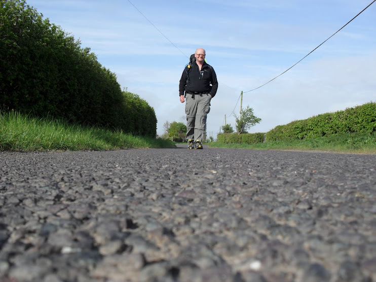
 |
| Start/Finish in Knighton |
Today, (Saturday - 7/8/13)saw the start and finish of the 135 mile long Glyndwr’s Way, the next National Trial to be ticked of the list. By leaving Knighton and arriving back there 5 hours later having walked to Llangunllo (once again good I can type it as I can’t pronounce it). I both started the clockwise walk to Welshpool and finished the return journey from Welshpool (on the anti clockwise return). If that sound double dutch, then it can be explained by me walking each leg of the walk in both directions as there is no other way to return to my car. Each leg will be 10 – 15km in one direction, so both will be anywhere from 20 -30km (x2). So when all finished I will have walked the whole route twice, there and back, hence starting and finishing on the same day. (When I get to Welshpool, that day I’ll finish the clockwise and “start”!!! the anti clockwise) Today’s walk followed the majority of a walk I completed two years ago, as the Birmingham to Aberystwyth Walk uses this route, but being determined to do all the GW route, it had to be done again. On the topic of the B’ham to Aber. Walk, I will be concluding it in 2 weeks time, as I have accommodation booked and the final leg from Devil’s Bridge to Aber is scheduled. Another video to follow! Today’s walk almost never happened as I had been watching the weather forecast all week, with its predictions of masses of wet weather over Wales. But having only two brief showers and never getting wet, once again the forecast was not wholly accurate, not for the first time this year.
Sunday 1 September 2013
Northumberland Coastal Path & St Oswald Way Video
http://youtu.be/tyH3MBaDGEA Click link to open video
Tuesday 27 August 2013
What's Next?
Two walks over the weekend, the first being a 25.4km walk from Rhayader to Llangurig, the penultimate walk on the Wye Valley Way. The walk included climbing to the walks highest point, which, as the laws of physics state should be at the source of the walk. However, the WVW does not beginning at the source, nor does it visit it, but it starts at the River Severn, a mile or so into its course.
There is a viewing point up in the mountains where you can see across the mountain to the source, this is the biggest let down of the walk, however, I'd still put it in my top 5.
Standing at the highest point then, I had a good view over to Pumlumon and the location of the source, so although the walk does not go there, I have a walk planned to visit the three summits on Pumlumon as well as visiting the source of the Wye and the Severn (again). October looks the best time at present. Following the final walk in September.
Additionally, we completed the walk across the Malvern Hill from Malvern to Ledbury, which was Leg 10 of 12 of the Thames to Wye Path, so getting closer to finishing that one, with a 20km and 12km walk to arrive in Hereford.
 Whilst the walk over the Malvern Hills were expected to be undulating, what was surprising was the up and down following the Hill, with uneven ground. To our surprise, the Bank Holiday Monday was the date of the Ledbury carnival, so the town was closed off, which resulted in us parking the other side of town and having to walk extra thro the crowds to the car. A total of 20.6km and lots of up and down.
Given both walks will be finishing shortly; plans are already in place the next walks.
Replacing the WVW for myself will be the Glyndwr's Way (GW). Logistics of this walk in the heart of Wales is going to be difficult, as there is little public transport, so the plan is I'll be doing the walk twice!! Parking at the previous walks finish, I'll walk out 10 - 15km until I find a location to park the next time and then return. The net effect being walking the whole path in both directions.
Replacing the Thames to the Wye will be Shakespeare’s Avon Way (SAW) from Naseby (Battle of) to Tewkesbury, via Rugby, south Coventry, Leamington, Warwick, Stratford, Bidford, Evesham and Tewksbury
Sunday 25 August 2013
Ncp Day 6 Fenwick to Berwick

 20.4km Day started with us making our way down to the Holy Island Causeway, once again like yesterday following the route of the St Cuthberts Way. It is here that the St Cuthberts, St Oswald and Northumberland Coastal Paths combine. The journey to the causeway seemed to be shorter than I remembered it being. Whilst St C's and St O's Paths, cross the causeway and end at the abbey on Holy Island, we ventured back onto virgin territory by heading north along the coast to Berwick. After negotiating the marshy land immediately after the causeway, we had a familiar choice of following the inland route on the map, just behind the dunes or venture out onto the beach and enjoy another "barefooted" walk. Once again the later was taken. As the tide was out the first half of the beach walk was completed without sight of the sea, just a vast desert of sand to the west. We met up later with the sea just before striking up onto the cliff's (low ones)on our final journey to the Tweed estuary. As Berwick is on the North side of the estuary, this meant following it in to the first of the three bridges. Here at the end the signposting went mad and we ended up making our own way to the start of the walk to the Train Station.
Just the video to do now, thinking of combining the St O path and NCP into one, will see.
20.4km Day started with us making our way down to the Holy Island Causeway, once again like yesterday following the route of the St Cuthberts Way. It is here that the St Cuthberts, St Oswald and Northumberland Coastal Paths combine. The journey to the causeway seemed to be shorter than I remembered it being. Whilst St C's and St O's Paths, cross the causeway and end at the abbey on Holy Island, we ventured back onto virgin territory by heading north along the coast to Berwick. After negotiating the marshy land immediately after the causeway, we had a familiar choice of following the inland route on the map, just behind the dunes or venture out onto the beach and enjoy another "barefooted" walk. Once again the later was taken. As the tide was out the first half of the beach walk was completed without sight of the sea, just a vast desert of sand to the west. We met up later with the sea just before striking up onto the cliff's (low ones)on our final journey to the Tweed estuary. As Berwick is on the North side of the estuary, this meant following it in to the first of the three bridges. Here at the end the signposting went mad and we ended up making our own way to the start of the walk to the Train Station.
Just the video to do now, thinking of combining the St O path and NCP into one, will see.
Friday 9 August 2013
Ncp day 5 belford to fenwick

A small blog entry to march rhe small distance travelled. Away from the coast the sea breeze had gone and left a hot steamy day, walking along ferns and over fields.
We soon joined up and shared the path with the st cutberts way, a walk we did some 18 months ago. Ending in the same b&b, with the same dummy in the front garden area.
Wednesday 7 August 2013
Ncp day 4 seahouses to belford

Today started with the choice of the inland route to bamburgh castle or the alternative beach route which required a tracing of our stdps back into the centre of seahouses.
Given the promising forcast a barefooted walk on the sand was a must. The impressive bamburgh castle was hidden by headlands and dunes until almost being at its doorstep, or should that be its drawbridge.
Leaving the coast and aiming inland, views across the massive sand estuary following bamburgh, holy island of in the distance on the coast and inland to the cheviots all presented themselves.
Later crossing of the east coast main line, following a phone call to the siignalman for permission to cross and a dart across the a1, where necessary before arriving at our destination of belford
Ncp day 3 craster to seahouses

Back to dry, sunny days, we left crasters to a still sea, different than the darkened skies from the day before.
A short walk to today,s castle followed, becoming memorable but the fact we thought we,d took a wrong turn, so in backtracking and correcting, adding half a km, we the. Found out hsd we continued an hundred metres we would hsve been on the path. Leaving dunstanburgh castle we drppoed down onto the beach for the first of two long beach alternative walks. Here treking shoes were kicked off for a barefooted walk along the shore, you dom,t get that on many long distance walks.
A lenghty break at a seaside pub and a lounge on bath towels st the next beach delayed our arrival into seahouses, where a long detour atound the habour awaited.
Tuesday 6 August 2013
Northumerland coast path

A taxi down to the beginning of the northumberland coastal path, delivered us under overcast skies. These got darker for the first hour followed by a sharp shower, driving under umbrellas sheltered us from the worst. Following this bright skies remained for the rest of the day.
Walking largely on the sand all day, we had the company of lots of walker (dog) runners and families.
The walk was extended with a lenghty rest on the beach, beach towel were rolled out, and paddling cooled burning feet.
Day 2 warkworth to crasters

The longest day of the walk on the wettest day.(according to the long range forcast)
A dry start was shortlived with the rain starting and continuing all day. Not that tbe seal we bumped into on the beach minded.
Walking out of warkworth in the dry, we passed the impressive castle, according to the guidebook, there are more to come, with bamburgh castle being the best.
Friday 2 August 2013
Northumberland Coast

 After the 6th June's post at the end of the Southern Upland Way, I used public transport to get to Warkworth, on the Northumberland Coast, to start a further 3 days walk along the St Oswald Path, eventually ending up at Hadrain's Wall and Corbridge. From where I made my walk home. The point of the three days walk was to join Hadrain's Wall up with the coast, all path of a series of path from the South West (Lizard) to the North East (Berwick on Tweed) walk. I had good weather over the three days, had the pleasant company of Alice, for 1.5 of them, has a good walk over the moorlands outside of Rothbury, ended up walking 26 mile on the second day looking for a wild camp. Having though I'd found one in a small field only to have the owners pass and see me, luckily just before getting the tent out, so on I went. (They didn't sound like they were going to be receptive to me asking!!) Anyway, tomorrow sees a return to the North East and the continuation of the St Oswald Path, also labelled as the Northumberland Coast Path, from Warkworth upto Berwick, plus a bit more at the beginning of the walk. Walking this "flat" walk, with my wife, there will be no camping, B&B's all the way. 11 mile a day average strolling and with our luggage being transferred, only a light day pack on my back. Certainly is the opposite of my recent Southern Upland Way adventure. I'll probally end up with seeing more people in the first day then the whole of the SUW as well. So Sunday is the first day. Blog to follow. In between the SUW and now I've been distracted from walking with being a taxi/luggage service for my daughter a university, decorating has also been on the card, but I have managed two more legs of the Thames to the Wye walk, having walked from Pershore to Worcester, including crossing the Severn. (so it should be called the Thames to Severn to Wye Walk). Followed then by a walk into the Malvern. (A walk across the Malvern Hills to follow) On the theme of River's I also completed the Rhayader to Builth Wells leg of the Wye Valley Walk, leaving only two legs left. This on what was the hottest day of the year at that point. The final walk over the hills into Rhayader was hard work in the heat. But the ice cream and cold coke in the town help the cool down.
 Sunday 23 June 2013
Thursday 6 June 2013
Thats all folks

The view of the coast was delayed, and seemed like it was never going to appear, this after crossings of the a1 and east coast mainline. A walk onto the sand and the customary feet wettening then occure with the sea rushing towards me rather than me gracefully dipping my toe.
The turnback inland following a fly packed coastal cliff, failed to conclude the walk of 212miles satisfactory for me
But as bugs bunny says "thats all folks"
Wednesday 5 June 2013
Dog day

Had one come for a closer look, but me just freezing disorientated him.
Once again i have overshot the orginal target to help reduce the final walk to the end of ghe suw and ho find a suitable wild camp. So i estimate 25km left to the end, closer to the coast as the end is back inland, where i need to catch a bus train bus to the next walk at either 14:30 or 16:30.
Tuesday 4 June 2013
Melrose arrival

Whilst sitting infront of melrose abbey, celebrating with a coffee and biscuit a delivery van parked right infront obsecuring all views. Obviously didn't recognise me or my achievement!!!!
The remaining day had me climb out of melrose, thro fields and country tracks in a north and north west direction, walking further away from my destination.
Arriving at my destinstion of lauder, was tempted to ask a local where was i, upon them answering, "lauder", i was going to shout "WHERE AM I", the old ones are the best.
Monday 3 June 2013
Onward christain soldiers

Following yesterdays additional mileage, todays 18.7km, was finished by 12:30, even with a lenghtly stop at the three breathrens caines and the sweeping route around the back of galashieds, which seemed to add a additional 3km.
Arriving early allowed a bath at the b&b, well needed. A shopping trip to the towns 24hr tesco, and panini at the local wetherspoons. Don't sound ike a long distsance walk much, does it.
The borders still continue to excel over dumfries, with there quality of path and interest. The walk over the mitchmoor drove road yesterday and today was a hit
Laudrette services have applied by the b&b land lady, washing clothes in streams does not have the cleaning abilities of a good auto washing mc, added to which i had to get rid of the bonfire smell to my clothes from when yhey were drying a st mary's loch. Them two idiots again!!!!!!!!!!!!!!
Mr blue sky

Followed a lovely walk alongside the loch and a short day of 19km to traquair, where there is a road junction, great.
Choices were, continue to the next town to a campsite there (and have someone keep you up), head for a "vandalised bothy, stop short of target and wild camp,(was 13:30-too early) or as i did, in true forest gump style, just kept walking, until at 17:00, i found a purfect spot, high in the hills. So not a 19km day, but 28.81km, camping at 445m. Which happens to be less windy than last night
Sky has been blue all day, so just kept to a slow plodding pace, no need to sprint, like yesterday, and now have only 15km into galashields tomorrow, where i will be stocking up again.
Sunday 2 June 2013
crossings

Other crossings today has been the west coast mainline, which was about 100m from my campsite last night and the m74.
The day after leaving beattock on my lejog, was the day that i hadn't secured the lid on my orange juice, which then leaked into my bag, no such mistakes this time, i'm glad to say.
Friday 31 May 2013
Tempted????

Todays 34.04km walk is the second longest, with tomorrows 1km longer? But the ascent is certainly the highest, being 1300m, and did i feel everyone of them. The ascent started immediately leaving wanlockhead this morning, climbing to the civil airplace tramsmitter on lander hill at 725m the highest point on the walk, the remainder of the day was a rollercoaster up and down. The later being in more boggy forest. The last?
So all in all a long hard ldp day, yep, gotta love them.
One third into the day, following the first batch of hills, i had a 500m road walk, where a car stopped and asked if i wanted a lift. I smuggly stated i was heading to the east coast, and he said he was off to edinburgh, were i could catch a train. Tempted???????
Wanlochead 99miles done

Usually after walking on a ldp, for about 3 or so days, i get in the swing and almost glide along, enjoying all. I'm having trouble engaging with this walk, like usual, and can't put my finger on why. It just doesn't seem to be as diverse as others, the path is less well looked after, the scenery doesn't change, and there's too many flooded bits. Thats a few reasons, but i haven't emotional attached yet. Maybe another night in a bothy might work?
Thursday 30 May 2013
engagement

Usually after walking on a ldp, for about 3 or so days, i get in the swing and almost glide along, enjoying all. I'm having trouble engaging with this walk, like usual, and can't put my finger on why. It just doesn't seem to be as diverse as others, the path is less well looked after, the scenery doesn't change, and there's too many flooded bits. Thats a few reasons, but i haven't emotional attached yet. Maybe another night in a bothy might work?
Water!

The campsite was not far from martyes grave, a site where 3 women where praying and where murdered by soldiers, added to the blood spilt, the walked passed the site where rob roy took on and defeated the english army, to add independance for scotland, his army chaged down the mountain side throwing missles at the english. As i passed i wondered would history repeat with john salmon, throwing ballot papers for scottish indepence at me.
The day ended in a b&b, with luxuries such as a bath and hair dryer, just whst was needed after the 31.9km, which ended with a hill as a sting in its tail
Monday 27 May 2013
After the sun came rain

Havin broken the day by a pub visit at dinner time and a bowl of chips, i had the final 11km of todays 32.9km walk to do (was tempted by the pubs b&b). The final walk had me crossing flooded stream inlets, some upto my thighs, with the main river which was in spat next to me. Ended up with just me boots on marchin thro them.
Buzzin at the beehive

Another bonus with the bothy was i was able to make a call home, there was a single position, seven feet up by the central pole which gave me a single bar of reception.
The other thing to note today, as sell as being sunny, was the almost musical noise coming from my bag today, with each two steps it made a "titty-to-tat" noise, had me singing along with it. This was however lost when i took the bag off at the first rest. Gone forever.
Saturday 25 May 2013

The start of the walk was almost a mirror image of the coast to coast, with a northern hike along the coast, a couple of coves and a lighthouse marking the point where you strike inland. Fortunately, on the suv, there is no dent to climb. For those not familiar with the c2c, dant is a 350 metre high hill on the first day.
prior to starting the trip, i had worked out the cost to the last penny, trying to save where possible, being tight. But one expense i hadn't prepared fir was paying 30p for the loo, twice now, once a Glasgow central station and the second, at portpatrick at the start of the walk. What makes it worse was this morning i got caught "jumping" the turnstile, thinking no one was around, when a woman suddenly appeared from side "office" and shamed me into paying.
Generally all is ok, but my expensive, liteweight sleeping mat has started to delaminate and blister, could be interesting, given its the first of 18 nights
Friday 24 May 2013
e2 started (again)

So e2 is well and truly started.
After walking back into stranraer and finding somewhere to eat, i have waited an eternity to order some food, i reckon i would have made it to nice by the time I'd ordered.
Wednesday 22 May 2013
Southern Upland Way next

Can't believe its been that long since the last entry, must have been in hibernation.
But, given the weather its not spring yet, yet alone summer!
In the time between I have been walking, finishing off the Thames Path in the first week of this year. One year to the day that I'd started it.


On the theme of River walks, I've since started the Wye Valley Way, leaving Chepstow, walking upriver. Starting in the first week of March. I, now find myself some 67% completed, having walked from Chepstow - Monmouth - Ross on Wye - Hereford - Westbrook - Llyswen - Builth Wells.
Having walked the River Seven, Thames and now well up the Wye, I must admit the Wye has to be the best.

I found the Thames flat and whilst nice walking in and out of towns along the walk and through London with its sights at the end, other than the distances it was not very challenging. more a means to complete its part of the E2 path.
The Severn was more diverse than the Thames, but large parts were flat, like the Thames. That why the Wye so far has been the best, its climbs up the Valley often, presenting great changing views and also goes through some cracking places, additional to those mentioned are Symonds Yat and Hay on Wye. Both places previously visited. I remembered the walk into Hay on Wye with Graham a few years ago on Offa's Dyke (and his End to End). so five stars so far and with interesting walks to end up on Plnlymon, I can't see that changing.
On the matter of River walks, my Thames to Wye Walk (Oxford to Hereford) with my wife continues, with us on the outskirts of Worcester, and whilst on a watery theme I also completion the Oxford Canal Walk.
 With me at Taunton on my Treadmill JOGLE and the other mountain walks, I actually completed 1169 miles last year, and am hovering around 350 miles so far this year. That however will significantly increase over the next few weeks as I am off this weekend to walk the Southern Upland Way, cross the South of Scotland from Portpatrick to Cocksburnpath. All as part of the bigger E2 path. On reaching the North Sea I'll drop down to Warkworth and walk down to Corbridge. So I expect a jump of 280+ miles.
Blogs are to follow, however, as the walk is through remote area's involving wild camps and Bothy stays away from civilisation some of these might be delayed
Subscribe to:
Posts (Atom)